10 Cities for Walking: Neighbourhood Routes Worth Slowing Down For
A city can reward walking without being small, flat or suitable for doing every journey on foot. Florence's river crossings, Edinburgh's Royal Mile and Kyoto's canal path offer specific routes, while hills, bridges and the return journey change how manageable each one feels. The best walking city for your trip is the one whose areas interest you and whose terrain matches the day you want to have.
These ten choices include suggested routes rather than a promise that every district is equally easy. Distances marked approx. are planning estimates for the named walk, excluding most indoor visiting and extra side streets. A three-kilometre route with galleries, steps and lunch can occupy much of a day. Keep transport available when it helps; walking well means enjoying the places along the route, not refusing assistance when your feet or the weather require a different plan.
Tuscan streets and Venetian bridges
1. Florence: connect the cathedral area with the Oltrarno
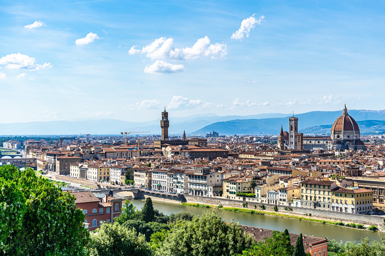
Florence supports a route from the cathedral area through Piazza della Signoria and Ponte Vecchio to Santo Spirito. Allow approx. 2–3 km before side streets and museum interiors, then use the Oltrarno as the afternoon's neighbourhood rather than returning across the river repeatedly. The route links recognisable public places without assuming that the Uffizi or cathedral interior can be squeezed into a few minutes between photographs.
A hilltop viewpoint is a different effort from a central street walk. Add it only if your time and energy allow, and retain an easier option near the river. The Florence restaurant guide can help choose a meal in the area where you finish. A gallery reservation and lunch break make a coherent walking day; the city's architectural richness does not require you to remain in continuous motion to enjoy it.
2. Venice: choose one crossing route rather than every lane
Venice can make a Santa Lucia–Rialto–San Marco walk into a substantial outing, with approx. 3 km on a practical route and more distance if you explore side streets. Bridges and crowded passages affect the experience independently of that number. Use a map that follows actual pedestrian connections; the nearest point across a canal may require a longer walk than its straight-line distance suggests.
The historic island city is car-free, but that does not mean step-free or effortless. A vaporetto can provide a useful alternative for the return, subject to its own route and boarding arrangements. The Venice dining pages help place a meal away from a hurried search at the end of the day. Walk through residential areas considerately and keep bridge access clear when stopping to consult a map or take a photograph.
Compact old towns with surfaces and exposure to consider
3. Bruges: use the canals to join distinct places
Bruges lends itself to a route from Markt and Burg through the museum-and-canal area towards Minnewater. Plan approx. 2–3 km depending on the streets and stops chosen, then decide whether the railway station is part of the final leg. Cobbles can affect comfort even in a compact centre. An unhurried museum visit belongs in the time calculation, not only the metres between landmarks.
Return to the canal area at a different time if you are staying several days rather than adding every possible street to one circuit. A coffee or lunch break can make the route easier to enjoy in changeable weather. Our European weekend guide places Bruges walking within a two-day itinerary, including the practical station journey that should not be forgotten because the centre feels easy to explore.
4. Dubrovnik: distinguish the walls from the street route
Dubrovnik offers two different walking experiences: street-level exploration around Stradun and side lanes, and the city-wall circuit of approx. 2 km. Steps, exposure and the direction of the walls route matter. It is a substantial activity rather than an automatic quick addition to a hot afternoon. The Old Town's UNESCO listing gives conservation context, not a guarantee of unrestricted access to every appealing corner.
Choose an early main walk when that fits the season and your timetable, then keep lunch and rest nearby. Many side lanes have steps, so a compact map does not make the whole Old Town equally accessible. Retain a lower-level route if the walls do not suit your mobility or the conditions. Any coastal excursion or boat trip should be planned separately rather than attached to the walk without time for a comfortable return.
Riverbank routes in larger capitals
5. Paris: choose a Seine-side section you can enjoy properly
Paris is better approached through a chosen river section than an attempt to walk every famous district in one day. A Notre-Dame-area–Louvre–Tuileries route is approx. 3 km before galleries and detours. The sequence gives you a clear western direction and several possible stops. Notre-Dame and a long museum visit remain separate access decisions; their proximity on a map does not establish how much visiting time either requires.
Use the Paris restaurant pages to identify a lunch area along or near the route, then take transport to another district if that is where you want the afternoon to begin. The value of walking includes noticing streets and river views between anchors. It does not depend on refusing the Métro when an ambitious cross-city extension would turn a pleasant outing into an exhausting obligation.
6. London: make the South Bank one connected outing
London offers a river-led walk from Westminster across to the South Bank and east towards Tate Modern, with approx. 3 km depending on the crossings and stops. This is one useful part of a much larger city, not proof that every London attraction lies within an easy central stroll. A gallery visit, riverside lunch and a shorter final walk can fill the afternoon without another remote appointment.
Choose the starting station and return route before leaving the accommodation. The London dining guide can support a meal near the day’s destination, while public transport makes a different district practical on another day. Bridges and exposed river sections need weather protection that a station-to-station distance does not explain. Our public-transport article discusses the network as a useful complement to a walking holiday rather than its opposite.
Scottish slopes and a Danish neighbourhood sequence
7. Edinburgh: give the Royal Mile time and side-street choices
Edinburgh connects the castle area and Holyrood through the Royal Mile, a route of approx. 1.8 km before exploring closes and other streets. It includes gradients and hard surfaces, so the distance alone understates the effort for some visitors. Use the National Museum of Scotland as another deliberate stop or a separate indoor outing, not a requirement to keep walking continuously through every old-town attraction.
Arthur's Seat is a separate hill outing with weather and terrain considerations, not simply the final kilometre of every central route. A New Town walk also provides a different setting from the Royal Mile and can belong on another day. Plan the accommodation return with the same care as the outward walk. A room near a landmark may still have steps or a tiring final ascent that changes how the route works for your group.
8. Copenhagen: combine the centre with one harbour direction
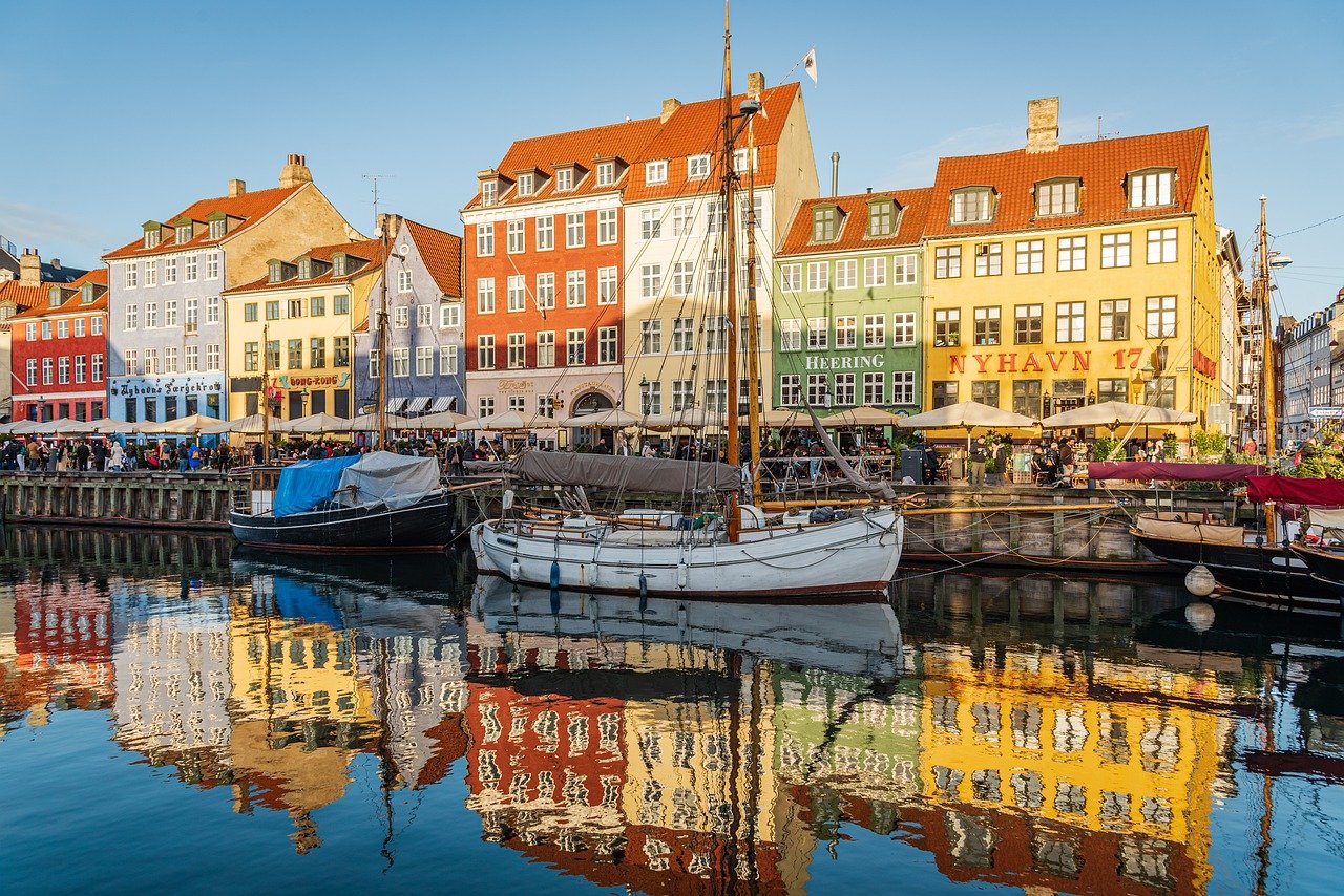
Copenhagen suits a route linking Kongens Nytorv, Nyhavn and a selected harbour section, with a museum or café as a main pause. A suggested 3–4 km outing depends on how far you continue and whether you cross the water, so draw the route before treating the harbour as a single short attraction. Another day can belong to Nørrebro or a different district rather than combining all neighbourhoods into one long loop.
Stay attentive to cycle lanes and keep them clear when stopping. A city with strong cycling infrastructure still asks walkers to understand the space around them. Public transport can provide the return or an alternative when weather changes. Our Amsterdam–Copenhagen comparison explains different art-and-design visiting styles, which helps choose the stops along a walk rather than deciding purely from a reputation for pleasant urban design.
Viennese cultural streets and Kyoto's canal path
9. Vienna: link public architecture with a proper collection visit
Vienna offers an architectural route around central portions of the Ringstrasse and the Hofburg area, with the Kunsthistorisches Museum as a substantial possible anchor. Choose a segment rather than assuming every important building needs to appear on a single uninterrupted circuit. A 3–4 km central route can already support an entire day once the museum, lunch and a coffeehouse pause are included.
The Vienna dining pages help place a meal where it suits that sequence. Schönbrunn is another area and normally benefits from its own transport-and-visiting plan instead of being treated as the end of a central walk. The city comparison tool can help choose between a culture-led Viennese stay and another route style. Walking works particularly well here when it connects selected interests rather than every palace and collection you recognise.
10. Kyoto: give the Philosopher's Path its own area
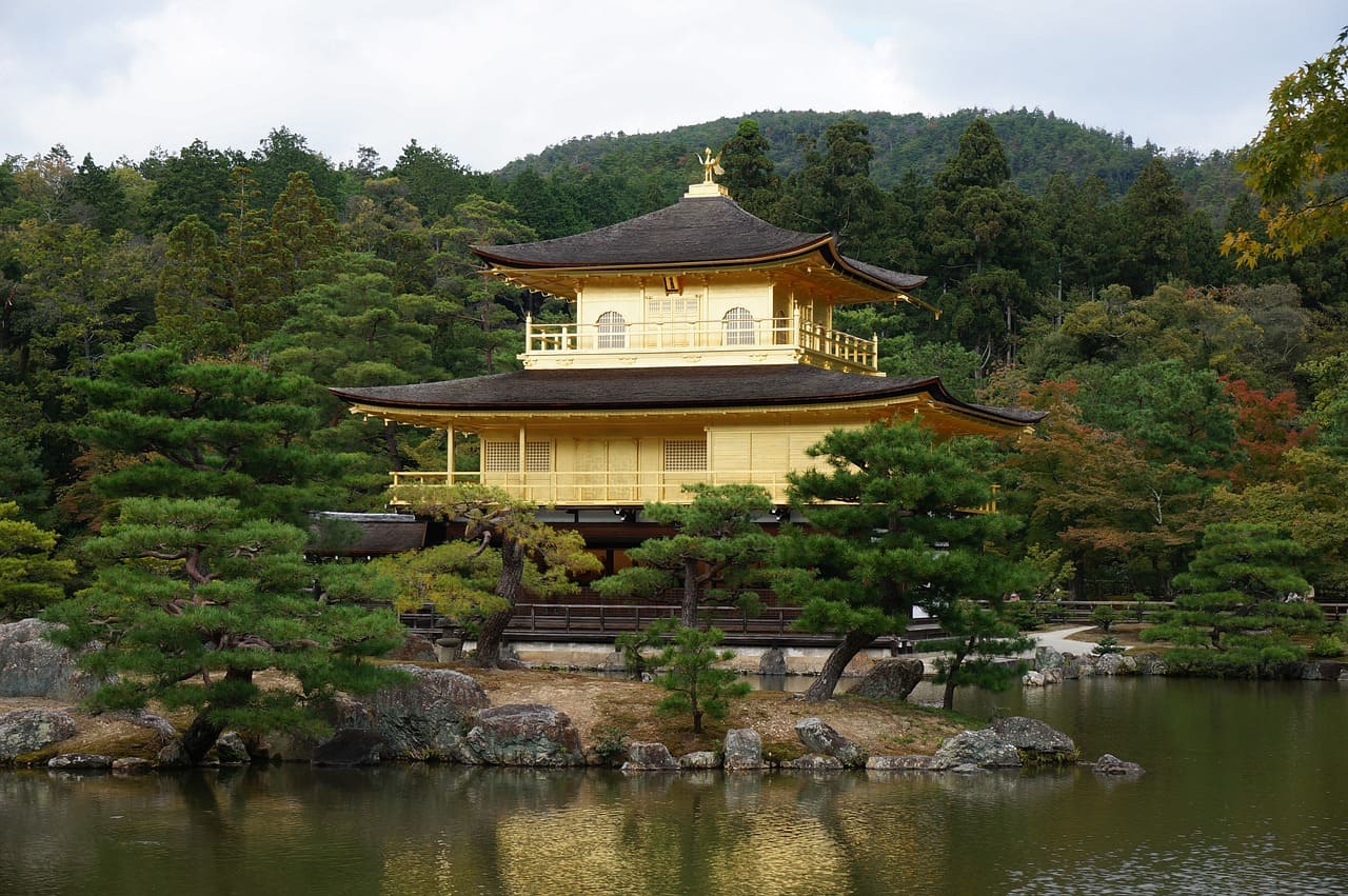
Kyoto has a famous canal-side Philosopher's Path of roughly 2 km, with temple visits and approaches adding distance and time. The northern Higashiyama setting is distinct from other Kyoto districts, so plan it as an area-led outing. Blooming cherry trees can be a spring attraction, but the route remains a walk through a living city and should not depend entirely on one weather-sensitive flowering stage.
Follow the Kyoto responsible-visitor guidance around residential access and cultural settings. Choose a meal through the Kyoto restaurant guide in a practical area for the day, and use transport for a separate destination rather than stretching the walk until it crosses the entire city. Kyoto rewards noticing one neighbourhood properly; it does not become a better walking holiday when every temple cluster is forced into the same route.
Read terrain and time as carefully as distance
The route estimates above are planning guides for the named sequence, not measured walking records or a prediction of your pace. A museum, meal, crowded bridge or steep lane can turn a short distance into a long outing. Set the day's main interest first, then choose the surrounding walk. The city-break planning method explains how to protect that anchor while leaving room to linger.
Use the best-time planner for daylight and broad weather context, then keep the current conditions in mind before a longer exposed route. Comfortable shoes and a modest load matter, but they do not eliminate access needs or make every surface suitable for everyone. The family holiday guide offers another practical perspective when a buggy, children or a multigenerational group changes the distance you would otherwise choose.
Keep a manageable endpoint and an easier alternative
Mark a meal area, a rest point and the transport option near the end of the walk. The travel budget calculator can include that return fare or an easier transfer rather than treating all spending on transport as failure. If the route becomes tiring, stop the optional part and retain the main experience. You do not need to complete a circuit simply because it looked attractive when drawn at home.
Choose attractions along the walk through current admission information, confirming prices and booked-entry arrangements when those affect your route. The neighbourhood exploring guide encourages attention to everyday streets and public activities without intruding into private spaces. A successful urban walk leaves room for a square, a shop or a view that holds your attention, with a clear way to finish comfortably when you have seen enough.
Frequently asked questions
Are all ten cities flat and easy to walk?
They offer worthwhile walking areas, but terrain and surfaces differ. Edinburgh and parts of Florence, Kyoto and other cities can involve climbs or steps, while Venice adds bridges. Choose the actual route and its return rather than treating inclusion in a walking shortlist as proof that every district suits your needs equally.
How long does a three-kilometre city walk take?
Elapsed time depends on stops, terrain, crowds and the pace that suits you. A route including a museum, lunch and several streets can occupy much of a day even when the point-to-point distance is modest. Use the named sequence as a planning estimate and leave room for the experiences along it rather than a fixed walking-speed promise.
Is using public transport a poor choice on a walking holiday?
Public transport can connect separate areas or provide a comfortable return after a satisfying walk. It is especially useful when a distant extension would turn the outing into a tiring obligation. Choose walking for the streets and places you want to experience, while keeping other modes available when they improve the complete day.
Links & Resources
Sources for ten urban walking routes
- Feel Florence: Ten urban walking routes: florence areas and visitor planning
- Venezia Unica: Ten urban walking routes: venice areas and visitor planning
- Visit Bruges: Ten urban walking routes: bruges areas and visitor planning
- Croatian National Tourist Board: Ten urban walking routes: Dubrovnik and the wider Croatian coastal setting
- Paris visitor information: Ten urban walking routes: paris areas and visitor planning
- Visit London: Ten urban walking routes: london areas and visitor planning
- Forever Edinburgh: Ten urban walking routes: edinburgh areas and visitor planning
- Visit Copenhagen: Ten urban walking routes: copenhagen areas and visitor planning
- Vienna tourism: Ten urban walking routes: vienna areas and visitor planning
- Kyoto Travel: Ten urban walking routes: kyoto areas and visitor planning